


Depending on which model you go by, we could be looking at 20s or teens by 2am Sunday morning. The NAM is trending a bit warmer, while the GFS and ECMWF are suggesting temperatures will sink below 20, at least for some of the northern territories. Both of these models tend to trend a bit on the cold side, so my thinking is that Mid Michigan will sink to right around 22-24° and the northern areas would hit right around 20°. Teens could definitely be possible in a couple of pockets though.

The GFS and ECMWF really turn on the freezer for Tuesday, though, and it's going to feel more like early January than early April. Both models are predicting temperatures in the single digits throughout most of Mid Michigan. Areas around the lakeshore should actually get a bit of a boost from the warm temperatures, so they would be closer to the teens. The good news is that it looks as though this would be accompanied by relatively clear skies (which makes sense considering temperatures usually drop at night when it's clear) and little wind, meaning wind chills may not be as much of a factor as they'd otherwise be. Both of these models could also be trending a bit cold, too, so we could wind up seeing temperatures closer to ten degrees in Mid Michigan and 20° near the lakeshore, if we're lucky. A brief warmup will be likely on Wednesday as a powerful warm-sector storm will likely pay us a visit, followed by another few chilly days. Things don't look like they're really going to bounce back temperature-wise until the week of April 10th.
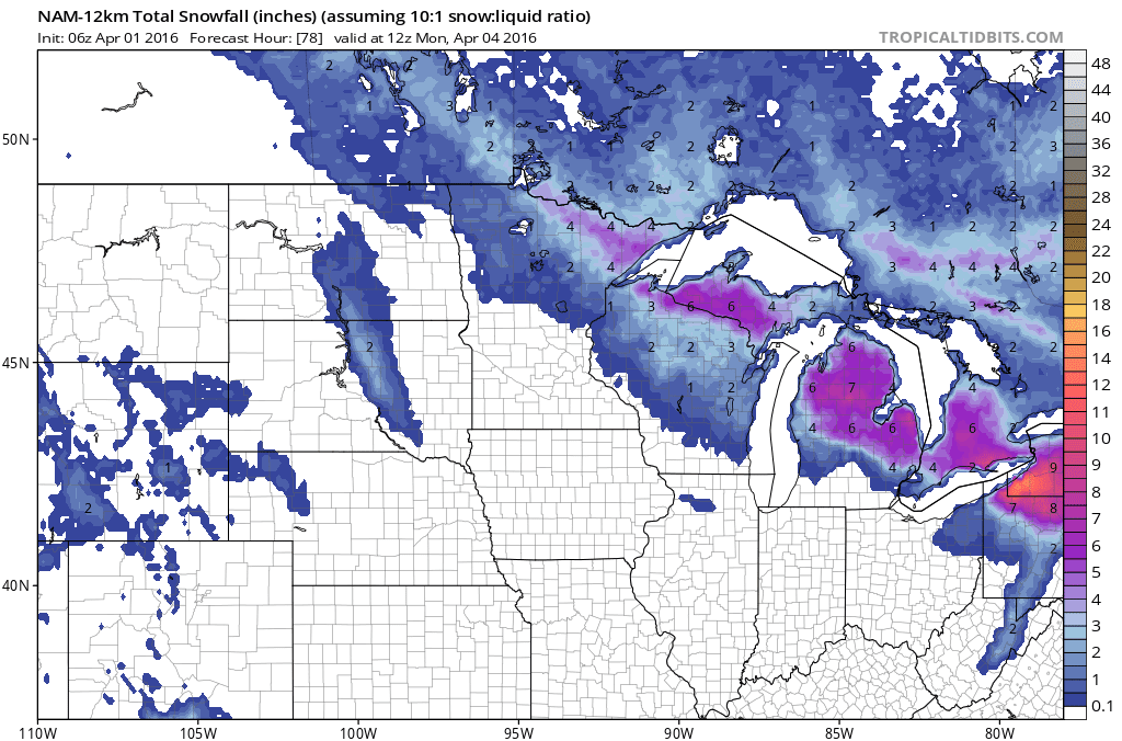
Now onto the part I'm sure nobody wants to hear about - snow.

We're going to have three potential rounds of it. Tonight's round should be light and not produce much accumulation. There is an indication that some areas may even see rain. Round two, however, should be all snow, and we could see as much as 2-4 inches from it depending on location. Round 3 should also be all snow, and another 2-4 inches could fall for a total of 4-8 inches in some areas by Monday morning.
This snow will likely melt off considerably on Wednesday should temperatures warm as much as what's being forecast. That's when another major storm system will likely pay us a visit and dump widespread heavy rain to add to our already oversaturated ground. Combined with the snowmelt and general wetness already present, I think we're going to be dealing with more flooding for at least the first half of April.
The good news is that there are some indications that the second half of April will be a bit warmer and a bit less wet for the second half of April. This will be very important for the agricultural industry, as of right now the fields are pretty much swamps.
To summarize:
• A cold, blustery weekend is ahead with some decent snowfall potential.
• There should be a warm-sector storm during the middle of next week, which should cause the snow to melt and add heavy rain. This will likely cause more flooding problems.
• The jury is out on the second half of April, but it definitely looks better than the first.
No comments:
Post a Comment