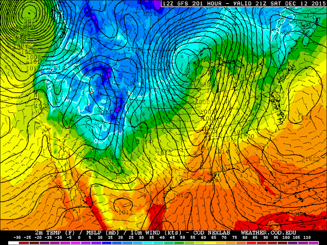
Madness. What I'm seeing the last few GFS runs predict for Michigan's weather 9-10 days from now is simply madness.
First off, lets take a look at the temperatures, though this is only half the story. Those yellow colors represent temperatures in the upper 50s and low 60s. That's right - 50s and 60s in Michigan in mid December.
If that's not crazy enough, take a look at the image below.
This is not merely a map of precipitation that's being predicted. This is what's referred to as convective precipitation. Rain caused by convection - in other words, thunderstorms.
We could be seeing rain and thunder in Michigan in less than 12 days. It's also tough to say just how intense said thunderstorms would be, as while instability would be marginal at best, wind profiles are, as they usually are this time of year, quite intense. We saw exactly what such wind profiles could do at the beginning of November.
I may yet be replacing that winter outlook with the thunderstorm outlook one more time this year. Nothing short of insanity.


No comments:
Post a Comment