Friday, July 29, 2016

The drought continues... but the geek will not - Farewell for now

This will be a dual-sided post. We'll start with the announcement, as the actual weather information should be relatively brief.

I've always had several passions: technology, literature, art, and science chief among them. Growing up in a community devoid of pretty much all four was not very easy. If you wanted technology, you either had to be rich and invest a ton of money into your hobby, or you had to rely upon what you could scare up here and there. This changed in the 90s as computers became more accessible and affordable, but when it came to learning anything about them, to this day, you're pretty much on your own if you come from rural America.. or at least my corner of it. The same goes for writing, art and science. Communities such as mine appreciate the practical over the whimsical and informative, and there's little question as to why, as it serves them very well.

Growing up, I never was sure which one of my passions would steer my destiny. At one time I had the aspiration, as do many gradeschoolers, to become a doctor. Looking back, I'm fairly certain that had I dedicated all of my time and effort into achieving this goal, I could've. I have family with a medical background, know plenty of nurses and am familiar enough with biology and chemistry to have made it work. It helped that I was in and out of hospitals for either myself or my family members for most of my youth, and witnessed such events as brain aneurysms and heart attacks when I was very young (for the curious, the victims were my family members, and they all survived their ordeals). I think observing the doctors, however, is what wound up putting me off of it. Long, unpredictable hours. Impersonal contact and coldly delivering potentially devastating news frequently. The slightest mistake spelling disaster. By the time I was a teenager, these types of situations did not appeal to me in the slightest. I loved to draw, but unfortunately I wasn't any good at it. I loved music, but I didn't see much of a future in it. I thought about being a writer, but neither journalism nor authorship came without extreme risk. Journalism would've required hundreds of hours spent trying to impress superiors, hoping to hit it big with a story that would make headlines. Attempting to write books, no matter the genre, was essentially sink or swim. I may yet do it some day, but just getting published, let alone making enough from your product to support yourself seemed like a long shot at best, especially when you come from a community where such ideas were dismissed as arrogant, head-in-the-clouds nonsense. And there were the other sciences, such as meteorology. I loved earth science. I loved weather. Some of the very first books I read were about storms and tornadoes. When I was 6 years old, I visited the library - the very same library I currently live across from - and would check out dozens of books on the subject. They were full of what I know today are complete myths and nonsense: tornadoes form from mammatus clouds, tornadoes have wind speeds of 800mph and more. Tornadoes cause such drops in pressure that buildings are known to explode - better open those windows during a tornado warning! Over the years, the information became more steady, and the myths were debunked, but it always fascinates me that we still have such trouble understanding a phenomenon that has been around at least as long as we have as a species, in this day and age. To me, the weather represents the last 'magic'. We've harnessed the power of the atom and have been successfully bending it to our will for over 50 years, but we still can't figure out how water vapor can, pretty much all on its own, create destruction on par with our most devastating weapon.

Come high school, I always knew it was going to be weather or technology. Don't get me wrong; I had just as much of a passion for tech as I did for tornadoes. I was exposed early thanks to my "granduncle", who loved to tinker with computers. I got to play around with modems before most people knew what they were, and when the internet revolution came, I was ready and waiting for it. To this day, I miss the "wild west" that the internet was in its early days, and all the fun ways you could mess with people online. Soon I learned to build my own machines, and machines for others. I was the one all of my family members went to with computer questions. I've worked support, development, network administration and network engineering. Eventually, this is what I made a career out of, and I don't regret it. The stability is great, as the demand for those who 'get' technology is always high. The pay varies depending on where you are, but its usually a cut above other fields. The prestige is mixed; some revere you as a sage while others see you as a child wielding an expensive gun pointed at even more expensive targets. It's a mixed bag, but you (usually) feel appreciated and needed.

The passion for the atmosphere and nature always remained. I learned about what made the atmosphere tick in my own time and begin to comprehend the long-winded hyper-esoteric posts put out by the National Weather Service and Storm Prediction Center. I felt, as I usually do, that people would learn to appreciate not only the atmosphere but the people who try to figure out what it's doing more if they had a translator, so I began to make equally long-winded Facebook posts breaking down the terminology. When I started this page little over a year ago at the behest of some of my friends, it was as a fun side-project and as a way to condense an incredible amount of Facebook posts into an easier to maintain format. I had a medium where I wouldn't have to worry about going over a text limit and could post multiple, captioned images or video without too much hassle. I was learning as I went and had a lot of fun.

However, unfortunately, things have changed. Quite a bit of personal turmoil has risen in my life lately, and I no longer find myself quite as inclined to post here. I've actually come to think of it as a chore - something I'm obligated to do, rather than something I look forward to. I don't do very well with that, and have been thinking about the future of this blog because of it for the past week or two. The final straw came today, when some work-related trouble arose because of it. The wrong people are reading this, and the last thing I need in my life is to wonder if more stress is going to enter my life because of a hobby. So, I've sadly come to the conclusion that the best course of action is for me to suspend making posts at this time, effective immediately. I will still post news on upcoming weather events on Facebook for those on my friends list (Phill.Wilson.509), but these too will likely be fewer. I may come back to this some day, but time will have to tell. For now, I believe there are more than enough resources out there for those who are looking for weather information and analysis without the need of a hobbyist such as myself attracting any more malcontent.

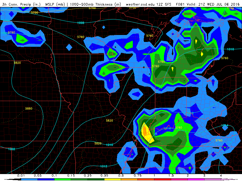
So I wrap up my final post for the foreseeable future with some information from the Climate Prediction Center. I wish this could at least be happier news considering the circumstances, but unfortunately nature, too, seems to be against me this year. I meant to make a post on this last week, but considering all that's been going on its no surprise I haven't got around to it.


In short, the drought we're experiencing in Mid Michigan and the Thumb is expected to persist into October. In looking at the long range models, I don't see any indication of much help on the way. The jet stream is incredibly weak this summer, and when it has amped up it hasn't been in our neck of the woods save for one or two occasions. Thunderstorm activity in general has been negligible, and even the portions of the state that aren't officially in drought are abnormally dry. It's going to take a massive weather pattern alternation for this to change, and I just don't see it happening any time soon. We have had plenty of moisture to work with, but days of high pressure ridges followed by extremely weak cold fronts isn't going to cut it. We need stronger cold fronts driven by powerful upper level disturbances in order to make it rain and thunder in Michigan, and they just aren't there. Time will tell what August and September bring, but I'm not optimistic.

With that, I close the book for the time being. Thanks to all who've supported me with this experiment. I'll be around, and I may yet come back to this some day. As always, it's wait-and-see.

Phill

Wednesday, July 27, 2016

Storms appear to be re-intensifying as they approach Thumb


Be advised that these storms appear to be intensifying a bit as they approach/cross the bay. Flood Advisory was just issued for Huron County. No severe warnings yet but the reports I'm reading indicate some damaging winds and these storms look like they're right on the threshold. If they intensify AT ALL as they make incoming on the thumb it could be a wild ride.

Some severe warnings going out - Nasty storms popping up in western lower MI

A very nasty cluster of storms just popped up about 50 miles south west of Cadillac heading toward a town called Luther. Baldwin also looks to be on the receiving end of this storm.


This thing has a lot of moisture in it and it looks as though it could produce some torrential downpours in addition to damaging winds and penny size hail.

Chance of rain, thunderstorms this afternoon in Mid Michigan

There is actually a good shot at thunderstorms developing in Mid Michigan late this afternoon. Mixed layer instability should build to around 1500j/kg by 5PM, however bulk shear values will not be particularly impressive at only around 20kts. This should mean severe weather chances are slim to none, but we could get a good soaking or two from the thunderstorms that do pop up. I wouldn't rule out a brief severe wind gust being possible either, as these updrafts and subsequent downdrafts may be short lived but strong.


More widespread rain and thunder is in the forecast for Thursday, but there's quite a bit of uncertainty as to just how much instability will be present, and we may only wind up seeing remnants. Here's hoping for a couple days of soaking to offset the continuing drought, now expected to last into October. More on that in a full post later.

Saturday, July 23, 2016

Rainy, stormy Sunday/Sunday night - heat will depend on storm coverage

The remnants of storms currently blowing through Iowa and Wisconsin are going to heavily influence our forecast tomorrow.


This system appears to be weakening as it moves east. Tomorrow morning may include some rain/thunder for the northern portion of the state per NWS Gaylord, but I'm with NWS Detroit in thinking its influence should be negligible tomorrow morning, making the NAM4KM's forecast a bit unreliable and the temperatures likely on the hot side. A marginal risk for severe weather does exist with any storms that form tomorrow, as the conditional threat for severe wind is there, but nailing down exactly where the biggest threat would be is going to be impossible until this thing evolves a bit more. I'm of the opinion that it's not going to be a very robust threat either way, as the weakening trends with this system should continue as it draws closer.

Thursday, July 21, 2016

Severe threat coming earlier than expected - Severe Thunderstorm Watch issued for most of LP, eastern U.P.

A storm complex is now expected to maintain its vigor and move southward through the state. As such, a Severe Thunderstorm Watch has been issued for most of the state until 5:00PM EDT.


The main threats are damaging winds and hail. I'm still concerned that we'll see another round of storms form this afternoon and plow through the area, but these may be more isolated/discrete in nature. A 2% tornado threat remains in effect by the SPC, which I'm assuming is referencing this second round. They've yet to issue an enhanced risk but this is pretty much certain to be on the way in a later update.

Wednesday, July 20, 2016

Heat Advisory just issued for large chunk of SE Michigan

NWS Detroit has issued a heat advisory for all of the forecast area except for the northern Thumb (Huron, Sanilac, Tuscola counties).


Text of the advisory is as follows:

...HEAT ADVISORY IN EFFECT FROM 1 PM THURSDAY TO 10 PM EDT
FRIDAY...

THE NATIONAL WEATHER SERVICE IN DETROIT/PONTIAC HAS ISSUED A HEAT
ADVISORY...WHICH IS IN EFFECT FROM 1 PM THURSDAY TO 10 PM EDT
FRIDAY.

HAZARDOUS WEATHER...

 * TEMPERATURES IN THE 90S AND HIGH HUMIDITY WILL CAUSE HEAT
   INDICES TO APPROACH 100 DEGREES ON THURSDAY AND EXCEED 100
   DEGREES ON FRIDAY.

 * VERY HIGH HUMIDITY WILL LIMIT THE POTENTIAL FOR OVERNIGHT
   RELIEF.

IMPACTS...

 * THOSE SPENDING TIME OUTDOORS WILL BE SUCEPTIBLE TO DEHYDRATION
   AND HEAT-RELATED ILLNESS.

 * ELDERLY PERSONS, OUTDOOR PETS, AND THOSE WITHOUT AIR
   CONDITIONING WILL ALSO BE SUBJECT TO HEAT STRESS.


PRECAUTIONARY/PREPAREDNESS ACTIONS...

A HEAT ADVISORY MEANS THAT A PERIOD OF HOT TEMPERATURES IS
EXPECTED. THE COMBINATION OF HOT TEMPERATURES AND HIGH HUMIDITY
WILL COMBINE TO CREATE A SITUATION IN WHICH HEAT ILLNESSES ARE
POSSIBLE. DRINK PLENTY OF FLUIDS...STAY IN AN AIR-CONDITIONED
ROOM...STAY OUT OF THE SUN...AND CHECK UP ON RELATIVES AND
NEIGHBORS.

   TAKE EXTRA PRECAUTIONS...IF YOU WORK OR SPEND TIME OUTSIDE.
WHEN POSSIBLE...RESCHEDULE STRENUOUS ACTIVITIES TO EARLY MORNING
OR EVENING. KNOW THE SIGNS AND SYMPTOMS OF HEAT EXHAUSTION AND
HEAT STROKE. WEAR LIGHT WEIGHT AND LOOSE FITTING CLOTHING WHEN
POSSIBLE AND DRINK PLENTY OF WATER.

   TO REDUCE RISK DURING OUTDOOR WORK...THE OCCUPATIONAL SAFETY
AND HEALTH ADMINISTRATION RECOMMENDS SCHEDULING FREQUENT REST
BREAKS IN SHADED OR AIR CONDITIONED ENVIRONMENTS. ANYONE OVERCOME
BY HEAT SHOULD BE MOVED TO A COOL AND SHADED LOCATION.   HEAT
STROKE IS AN EMERGENCY...CALL 9 1 1.

Confidence growing in severe weather event tomorrow evening

Well, I'm gonna have to bite again, even if the apple is snatched away at the last second, because the models have changed their tune big time. I no longer think we're going to be capped on Thursday night/Friday morning, and we could easily wind up with a nocturnal MCS if not a true derecho plowing across the state.


Some of the instability levels being forecast by the SPC ENSEMBLE - not just one model but the weighted average - are on the order of 3000-4500j/kg MLCAPE. That represents an EML plume; an "elevated mixed layer". The "mixed layer" is the area in the atmosphere where all the action takes place. This is the area is the battlefield where the war between warm and cold air is fought. The 'deeper' the mixed layer - that is, the more vertical space on the battle field - the more carnage can take place. The mixed layer is considered "elevated" when it reaches very high up, is particularly deep and very unstable - lapse rates (temperature of air as you get higher) tend to be steep. Such conditions usually result in a weak cap at the lower levels of the atmosphere which prevents thunderstorm activity until peak heating. This is when you can get the explosive growth of supercells and severe multicell clusters depending on how favorable wind shear is for said development. 

Bulk shear of 40-50kts should be more than enough to drive explosive thunderstorm growth, and most of the models are coming in with supercells developing into an MCS over the upper peninsula in the late afternoon. This will drape southward across the lower peninsula by late evening/overnight, likely bringing a significant damaging wind threat.

I do see our probabilities going up if this forecast continues to show up as is over the next day, so make sure you're spending tomorrow night in substantial shelter. As I've had a bit of an active week, I'll do my best to keep everyone posted about this. I don't think lack of sunshine is going to shut off the severe threat this time around, as this system is fueled by the torrid heat and humidity settling in over the central US, and actually looks like it'll be on the powerful side.

Monday, July 18, 2016

As heat watches and warnings are issued for the central U.S., Michigan enters the Ring of Fire


Unless you count the above normal temperatures and the completely baffling level of dryness, it has been quite the uneventful summer in Michigan, weatherwise. Save for two Fridays ago, we've really had no significant nor widespread severe storm days thus far, and truly we've been devoid of even meaningful variety in our forecasts. Days which looked like they could be active have for the most part been duds, and overall predictability is quite low.

It's tough to say that this is going to change, at least for me, at this point. Watching the models, I see similar patterns to what I've been seeing since the end of May: potential for big storms. But that's the key word: potential. A couple of weeks back, I was all but certain we were going to be seeing a meaningful thunderstorm event in Michigan, and it failed to materialize in epic fashion. Some areas to the south and extreme east did see some thunder, but it was hardly noteworthy, and the central portion of the lower peninsula in particular has missed out on just about everything. We are deep into drought at this point, and we're likely to be looking at drier than normal conditions until the fall at the very least. Will we be as dry as June? Probably not. It would take incredible bad luck for this to happen (especially in the coming week), and I just can't imagine (or perhaps just don't want to) the systems refusing to drop any rain over our areas the way they did in June. With that in mind, the overall pattern remains what it is, and it very well COULD be another 1988-style summer.

Some good news is that the pattern forming is a bit more extreme than the one in June. The flow of the jet stream is similar, but this time around a torrid, ridiculously hot pattern is building into the central midwest. We're talking heat levels that are prompting warnings in areas that routinely see 100°+ heat indices each summer. 115-120° heat indices are not only possible but likely in those areas this week. These are extremely dangerous levels of heat that can be life threatening, so if you plan to be in these areas or know someone who is, spread the word of caution. Michigan's position will be just outside this area of heat, in the shadow of the jet stream flowing from northwest to southeast. Normally, I'd say that this would mean a high likelihood of severe weather in the coming days. With the year being what it is, however, I'm going to take a more measured approach. Could we see severe weather? Absolutely. Will we? I'm actually doubtful.

The reason is that I'm seeing a lot of the same behavior out of this upcoming system that I've seen in the past. The system will build up a lot of energy just to our north and west, probably ignite some furious thunderstorms, and then they will likely fizzle out in epic fashion just as they reach Michigan. This is best shown by the latest NAM model. The western U.P. could see some impressive storms, but the rest of us are going to be lucky if they last long enough to dump any meaningful rain. Convective turnover and subsequent capping has been the villain of the season in Michigan, and it doesn't appear that anything's changing even with the additional energy.

Perhaps nature will defy the model predictions and my overall gut feeling on this one, but each and every time I think that we're settling into a more rainy pattern, I'm kicked in the teeth. The shoe has to land on the other foot sooner or later, but I'm now of the opinion that it will be later.

Saturday, July 16, 2016

More big time severe weather looks possible for tomorrow

A pattern which to me looks a bit similar to last Friday's will be making its way into the region tomorrow. Once again this system looks to have some power behind it. Latest guidance has pushed some of the power down a bit - 50-60 knots of bulk shear was being advertised in previous runs but now only 40-50 knots are - but this might have something to do with the system becoming a bit more "stretched" which would actually put storms into our area rather than to the west where they were showing up in previous forecasts.


Regardless, 50kts is still plenty of horsepower and combined with even marginal instability would be enough to drive severe thunderstorms. The questions that remain are how much instability will be able to develop, as more potential energy always helps, and whether or not overturn will occur. What's driving my decision in posting the outlook that I'm posting is that the NAM4KM has been a bit more accurate over the last few weeks, and it's predicting a train of thunderstorms through the Mid Michigan area in its latest run. I'm actually a bit more concerned about flash flooding with this one, but in looking at it I'd say all hazards are possible. On a scale of 1 to 10, I'd say it looks like a solid 5, hovering around the storm strength we saw last Friday.


The top image is what the NAM4KM is predicting will occur over the next 42 hours. The bottom is what it would predicted would happen last Friday. Note both the similarities and differences, but I think we have a fair shot at some pretty severe weather tomorrow.
This forecast could easily change. I think this has the potential to be a bit more widespread if certain things happen. On the flipside, it may be a complete dud. We'll know a lot more once some more models are able to run and things come into focus.

Tuesday, July 12, 2016

Rough weather may be on the way again tomorrow

Some thunderstorms are moving through the state this afternoon but it doesn't look like anything truly nasty will come from the line. An official 20% chance of severe thunderstorm watch remains in effect until this evening per mesoscale discussion, though at this point I think the chances are lower. The good news is that rain chances may be on the rise as the line seems to be holding together well.

However, tomorrow afternoon could be a different story. A slight risk of severe weather has been issued by the SPC for the majority of Michigan, both upper and lower.


The models are diverging a bit on this one. The 12z NAM puts the nastiest weather through Mid Michigan once again, while the 18z run confines very nasty weather to the southernmost portion of the state. The two runs can be compared below:


Each dark green swath represents the path of a potentially severe thunderstorm that the model predicts will strike.
With this divergence, it's tough to say where the biggest storms will be tomorrow until more runs come in and more data can be obtained. I suspect that tomorrow will yield another watch.

Friday, July 8, 2016

Very active afternoon draws to a close - Possible gustnado funnel captured

Some very intense thunderstorms will make July 8th 2016 one of the highlighted severe days of this year. This system really amped up as it approached Michigan this time around, which is exactly what we're going to need going forward if we want to get out of the drought.


This picture sums up the day for me. Thanks to Brenda Kelley for the awesome photo - I got video of this but no pictures. I called this one in to NWS Detroit as it appeared at the time to be a textbook funnel/wall cloud. I was told that it was probably a shelf cloud, but I know my shelf clouds, and this it was not. Looking at it now, though, I do think that it WAS part of a shelf cloud; this is a phenomenon known as a gustnado (or gust funnel, since there's no evidence that it touched the ground). Shearing winds along the gust front of a storm can generate these phenomenons, which can touch the ground and produce damage similar to a weak to moderate tornado. They usually don't last very long. Either way, quite the sight!

Widespread severe weather event unfolding across Michigan

A significant severe weather event is now unfolding across the state. Numerous reports of damaging wind and large hail are coming in with discrete supercells forming across the lower peninsula. As it stands, the north is currently bearing the brunt of the storms, but conditions are actually more favorable in the south, especially across the Saginaw Valley and Thumb area.


A Severe Thunderstorm Watch is currently in effect for essentially the entire lower peninsula as this dangerous and powerful front makes its way across the state. The SPC has upgraded most of the lower peninsula to an enhanced risk for severe weather, with a 30% chance of damaging winds and large hail. The tornado risk remains relatively low, but I believe that it is more localized to the thumb area where no storms have yet occurred, which is why we've yet to see any tornado warnings. I will be observing this system very carefully as it approaches and attempting to keep everyone in the loop with new developments.

Severe thunderstorms likely today with elevated tornado threat

Yesterday's atmosphere managed to produce some pretty powerful storms in Mid Michigan. Over 2,500 customers are without power in Saginaw County after a severe warned storm moved through. Most of the Thumb got a good soaking from that storm, too. A great deal of the state wound up seeing some thunder last night, and I'm hoping that the conditions in the forecast for today equate to an even better coverage of rain than yesterday's. Unfortunately this rain may also come with a fairly decent chance for severe hazards, including tornadoes.


These graphics represent something known as "updraft helicity". What the model does is first predict that a thunderstorm will form over a given area. It then predicts how much "spin" the storm's updraft will have, and the momentum of that spin. The stronger the values, the more rotation it predicts. The swaths you see appear in dark green and yellow represent the paths of storms predicted to form this afternoon. The HRRR model is calling for some pretty strong rotation to be associated with these storms. Last night's NAM4KM run also predicts strong rotation in some of the storms expected to form.


It goes without saying that the more rotation is present in a storm, the higher the likelihood of severe hazards. At this point, the SPC has designated most of eastern lower Michigan for a 2% tornado risk, and a 15% damaging wind/hail risk.

I'm actually thinking the chances of severe weather today should be pretty good. Unlike the previous systems we've seen come through the state, this one has some power - to the tune of 40-50kts of bulk shear. That means that wind speeds will increase by 40-50kts between the surface and the tops of the thunderstorms. Timing is also on our side this time, and capping appears as though it's going to erode by the early afternoon while CAPE levels rise to around 2000j/kg or more. The setup has also seemed to fall right in line with and in some cases even outperform what the models have predicted thus far.

As much as I don't like the idea of anyone getting hit by a tornado, I'm of the opinion that any storms we get that don't carry some severe risks wouldn't be able to offset the drought at this point. We need some more powerful storms that carry very heavy rains to reinvigorate the earth in our area. A few days of storms like this, once a week or so for the next couple months, is a great prescription for a drought recovery. If any tornadoes do strike, I'm hoping they'll be over open country, in front of someone with a camera.

Thursday, July 7, 2016

Severe weather chances BACK ON for tomorrow afternoon, especially for northern lower MI and the Thumb


A severe thunderstorm warning is currently in effect for the Houghton Lake and St. Helen areas of Roscommon County as a powerful cluster of storms moves through the area. Some rather strong storms are also present north of Grand Rapids, in an east/west line between Shelby and Big Rapids. These storms will continue to propagate eastward, and a great deal of the lower peninsula could (finally) be wet by tomorrow morning.


...Which leads me to an important conclusion about tomorrow, and is also the reason that the SPC has a great swath of lower Michigan now under a slight risk for severe weather tomorrow as well. This system has picked up some steam.

By 9AM tomorrow morning, the rain should be off to the east and skies should be clear. This means that most of the full power of the day's sun should arrive to increase instability levels. Some models are showing very high instability levels, but NWS Detroit currently estimates things to top out at around 2000j/kg of SBCAPE by tomorrow afternoon. This is still more than enough instability to power thunderstorms, and with the system amping up in terms of power there are signs that the rockets could actually launch this time around.


The NAM4KM in particular is signalling some intense thunderstorm potential. It's forecasting supercells with some very powerful rotating updrafts, which could signal a tornado threat. These would then merge into a line and bow outward as they become more forward dominated, which would present a very strong damaging wind threat. The track of the storms being predicted is evident in the pictures above.

Two runs of this model have made this prediction, and the Rapid Refresh looks to be setting up a similar scenario.


40-50kts of bulk shear should provide more than enough horsepower to keep things running strong. Storms are forecast to ignite around 2-3PM across the area, which would mean they'd intensify as peak heating hours arrive. My hope is that this actually pans out this time, as a great deal of Mid Michigan is officially under a moderate drought (see image below). We absolutely positively need nt just rain, but thunderstorms that bring intense rainfall in order to turn things around.


Let's make this happen this time, Mother Nature! We need water!

Looking better for rain tomorrow, severe threat pretty much gone for eastern MI

It looks as though we won't have any severe weather to worry about on this side of the state today or tomorrow. The rain potential looks about on par with if not a little greater than last weeks. As these storms will come through in the morning, we shouldn't have to worry about things drying up before they pass through the area.


Most forecasts have pegged about a half inch of rainfall throughout the eastern areas, but some areas (like Flint) may get lucky and see up to an inch.

Wednesday, July 6, 2016

Chance of thunderstorms today looks better, potentially widespread rain tomorrow, Friday

Chances for precipitation in the lower peninsula look to be increasing as more models come out. The SPC continues its marginal risk for the northern half of the lower peninsula, and I'm now seeing more evidence in the models of potential thunderstorm development in the state than yesterday when the marginal risk covered the entire region. To that end I've actually included the Thumb area in a marginal risk in my outlook as a pop-up severe storm can't be ruled out during peak heating time, per model guidance.


Some models are suggesting that tomorrow afternoon may be quite active for the southernmost portion of the state, while others are downplaying the northward extent of the activity/potential. I currently don't think there's much of a threat for severe weather in Michigan tomorrow per se, so I'm matching the SPC's current outlook of slight risk for extreme southwest and marginal for most of the rest. 

Friday is still a crapshoot depending on what happens today and tomorrow. I'm still thinking the eastern portion of the state could be looking at some severe weather based on the latest models, especially the high-res ones. I'm going to maintain my isolated/severe likely outlook for now pending the midday run. Right now the NAM4KM has thunderstorms popping up over western lower MI on Friday at around 2PM. These would likely gain strength as the front moved east in an increasingly unstable and sheared environment.  


Tuesday, July 5, 2016

Friday looks like the best shot at storms

I'm going to start off by giving my opinion: I do not agree with the SPC's current marginal risk status assigned for Michigan tomorrow - I simply do not believe we're looking at any severe hazards, and that rain, let alone strong storms, will be hard pressed to survive the night into our area. It's much more likely that the storms out west will dip south through Illinois and skip Michigan completely, leaving only a few chance showers for our region until Thursday.


The jury is out on Thursday. The GFS and lower res NAM models indicate widespread rain present over the lower peninsula, though the higher res NAM4KM indicates nothing of the sort. It'll be interesting to see what the higher res models come in with over the next few hours. Keep in mind that the GFS continues to predict widespread rain for tomorrow, so I don't know if I trust its forecast much right now.

Friday, for now, definitely looks more interesting. The classic hallmarks of a severe thunderstorm-producing system are all present in the forecast. That said, this has happened before this year, and nothing has panned out, so this outlook is tentative at best. I think it's safe to assume a decent chance of strong to severe storms in at least the eastern part of the state on Friday afternoon.


Temperatures are definitely tempered back from what was earlier predicted, approaching if not quite making it to 90°. Dewpoints will likely be around 70°, making a for a very humid end of the week.

Sunday, July 3, 2016

Temperatures not as impressive, but still high - Chances for multiple rounds of rain/thunder look good

Big changes to the forecast from yesterday in terms of temperatures - I no longer think we're looking at record highs. In terms of precipitation, a very positive forecast is being put forth by the GFS which indicates multiple rounds of rain and/or thunder likely to affect Michigan toward the middle to end of next week. This looks more like a common late June/early July pattern than the absurdly dry one we've seen so far this summer.


The NAM is starting to get involved in the forecast, too, and hot temperatures look to be on the way even earlier than I first expected, but not to the same degree as what was put out yesterday. The model is forecasting temperatures in the upper 80s to low 90s by Tuesday, and potentially the low-to-mid-90s by Wednesday. This should be a very humid heat, too, with lots of moisture to make it feel even hotter. Dewpoints in the 60s and 70s will make things feel somewhat uncomfortable. The good news is that it definitely looks less oppressive by Friday, where as yesterday these conditions were looking as though they'd last beyond next week. The absurdly high 80° dewpoints appear to be gone from the forecast, too, though I never put too much stock in those. We do not currently look likely to hit 100°F anymore, either.


I'm still hoping that this week will mark the end of our abnormally dry conditions this summer. We have the opportunity for several rounds of rain and thunder in the Great Lakes region as several potent waves make their way toward Michigan beginning Wednesday. This potential should last until Friday and into the weekend. It's going to be all about track and timing. The odds are with us this time around that at least one of these waves will produce something. I'm hoping we'll bat 1000 this time around, and be well and mighty drenched by this time next week.

Saturday, July 2, 2016

Get ready for the heat - Multiple rounds/days of severe weather possible, too

Well, here we go again with another teaser. One of two things are going to happen within the next week: we're either going to sink into drought, or we're going to break our dry snap in an epic fashion.

The GFS in particular looks very promising, if not a little concerning. I'd be much more concerned if the patterns had favored us for storms as of late. This pattern is looking similar to what I was watching in the middle of June, when everything started looking like it was going to explode, but then decided to fizzle out and skip Michigan. It also shares some characteristics to what I was looking at toward the end of June in that, should it manifest, it could be a multi-day severe weather event. Keep in mind that multi-day doesn't necessarily mean multiple days in Michigan, or even one day in Michigan, but that potential is definitely there.

First up let's talk temperatures record highs. Fact: we're looking at multiple 90° days here. Even the usually temperature conservative ECMWF is throwing 90s around like they're nothing. And when I say multiple I mean a potential four-to-five day stretch. We have a very legitimate shot at 100°+ on one or two of those days. I see no relief on the horizon until the 13th or the 14th at the earliest. This has been predicted over several consecutive model runs and by different models, so it has a very good chance of happening. 2016 may go down as one of the hottest summers in Michigan on record.

Yes, you're seeing that right. That's a hundred degree forecast for Monday July 11th.
Next, let's talk dewpoints. If you shudder at the thought of 100°F weather, you may want to pack your bags and head to Canada for the next week, because the dewpoints are going to make it feel like it's much hotter - 10 to 20 degrees hotter. Widespread 70° dewpoints are almost certain, with multiple days of 75° dewpoints possible. Think that's oppressive? There's even some hits in the models that dewpoints will make a run at 80°F. Consider what that means for a moment: imagine that it's 80° outside, and there's fog as thick as pea soup. That's the amount of moisture in the forecast. 70° dewpoints are considered tropical. When you start getting higher than that, we're talking equatorial rainforest here.

Where you see spots of pink are where dewpoints are forecast to hit 80°. That forecast includes Detroit on Sunday. This will be tough to achieve and rather exceptional if it happens, but I do think widespread 70-75° dewpoints will be likely.
So how about instability? Well, the GFS is predicting a sustained EML plume will make its way across the region, equating to some ridiculously steep lapse rates. With the temperatures and dewpoints predicted to be what they are, the GFS is forecasting a few days of SBCAPE exceeding 5000j/kg for pretty much the entire Great Lakes region. This is a nuclear yield in terms of energy should it be tapped into by thunderstorms, Should storms have any kind of horsepower behind them in the form of decent low/mid-level winds, it's pretty much derecho/tornado weather. There are several days forecast where it looks like the amount of shear could help produce extraordinarily strong severe thunderstorms. The questions will be: a) how much capping will be in place on each day, and b) will storms make it to Michigan?

Our best shot at storms should be Friday, when what's forecast to be a very strong closed low is expected to be situated over extreme western Ontario. Storms would likely take the form of an MCS out of Wisconsin.
I think we have a good shot this time, but I've been bitten enough times by the forecast this year to say that nothing is guaranteed. I'm not going to put out any outlooks until the SPC makes more statements and more models come in. In terms of a motor, this system looks like a good V6 or V8 engine, if not quite a twin-turbocharged behemoth. In terms of fuel, it has an endless supply of gas should it be able to tap into it. The trick is getting that engine started, which hasn't happened yet this year for us.

Friday, July 1, 2016

Widespread, if not particularly intense rain this morning - Turnaround on the way?

Some potential good news may be on the horizon for the abnormally dry, not-quite-drought-stricken lower peninsula. It starts with what occurred this morning - the MCS out of the northwest held together pretty good this time around, and just about the entire state saw some measurable, if not quite decent rainfall.


This rainfall is not nearly enough to offset the extended dry period we've been seeing over the last few weeks, but it hopefully will be enough to keep the dust down a bit better and reduce some of the fire weather conditions to the point where the Fourth of July will be a relatively safe holiday. No statewide fireworks bans are anticipated at this time. As always, check with your local county sheriff as to which days it is safe and lawful to set off fireworks.

The other part of the good news may be what's to come; our ridiculously dry June may give way to a more normal first few weeks of July. I warn you straight away - for this prediction, I'm turning to the models, and we know how those have been over the past month. However, I do believe that there's only so many times you can roll snake eyes before you HAVE to get something else, and more than a few model runs have been suggesting some decent thunderstorm potential over the coming week to two weeks.

There's a bit of back-and-forth regarding the mid-to-upper level winds and the east/west position of an upper-level trough in the last couple of GFS runs. This could have a big impact on where storms first fire up and what their upper level support will be, but it looks like low level and surface conditions will begin to become ripe for thunderstorm development in the Great Lakes region starting next Thursday. Temperatures should soar into the upper 80s and low 90s. Thursday has nothing on Friday, though; upper 90s to even 100°F are being forecast for Friday, July 8th. Dewpoints are forecast to be nothing short of oppressive to the tune of 75° - even if we come out on the low end of this forecast, we're going to have low-to-mid 90s with 70° dewpoints. This should send heat indexes into dangerous territories which we haven't seen in a few years. A real risk of heat-related injuries may be present throughout Michigan on Friday. To give you some idea of what we could be looking at, the calculated heat index of the worst case scenario being put forth by this model (temperature of 100°, dewpoint of 76°) equates to 115°. Stay close to areas with air conditioning next week.

All of this heat should produce a ridiculous amount of instability in the atmosphere. The question now is going to be what kind of capping and forcing for ascent will come along with it. The latest GFS has the cap eroding by Friday over Wisconsin. This could lead to widespread thunderstorm development and a potential MCS (widespread linear/semi-linear storm system) moving into Michigan overnight Friday into Saturday, if the position of a cold front cooperates. The GFS has a warm front moving into the area Friday and a cold front not far behind it, so this could easily happen. Storms could also develop along the warm front, though again, this is going to depend heavily on how much capping is in place at the low levels of the atmosphere. This model is also hinting that low level wind speed should be quite strong - 40-50kts. Mid level winds are a bit more tame, so bulk shear values are coming in around the same, but with mid-level winds that strong any storms should have a chance to be more organized.

From what I can see, the latest ECMWF is mostly in agreement with the GFS, although its range is somewhat limited at this point. More will be shown in subsequent runs. Rumblings from NWS Detroit seem to also indicate better chances for thunderstorms in the coming week. The latest forecast discussion expressly mentions a better chance for scattered convection. The SPC also specifically mentions a severe risk in the upper Great Lakes during the day 5-7 period, though predictability concerns preclude any highlighted areas.

The forecast definitely looks better than it did a week ago, and hopefully this morning's rain will reduce some of the allergy misery. THAT, at least, can't get any worse!

Wednesday, June 29, 2016

Upcoming chance of rain looks sadly similar to the last system

Friday's chance of rain may determine whether or not the State of Michigan's fire marshal temporarily bans consumer fireworks (as well as burning) ahead of the Fourth of July holiday. Our conditions are beginning to become dangerously dry in a lot of areas, and while no federal fire risk zones have been issued for Michigan yet, the threat is there and I don't think we're that far away from at least an elevated risk day if we don't get some rain soon.

Our chances may be a bit better than last time, at least according to some meteorologists. The system is forecast to reach deeper into Michigan this time around. However, I'm concerned that what we'll be seeing is nothing more than a repeat of last time for the Thumb with only a slightly more eastern reach. The system may dry out as it crosses Mid Michigan and be completely gone by the time it hits the Thumb. The Thumb would once again remain mostly dry as the system rebuilt to the east over Ontario, and to the south over Ohio. It would be enough to get Mid Michigan wet, but east of Bay City would be out of luck.


With that in mind, the last system was forecast to dissipate sooner than it did last time, with thunderstorms forecast to form over the Thumb. I was supremely confident in the forecast as literally every model was in agreement as to what was going to happen, and atmospheric observations all pointed to the same scenario. Because of this, I along with quite a few experts were left shaking our heads last weekend. If the models repeats their same mistakes, we could wind up getting something out of the remnants from the previous day after all. I hope that this is what happens, as not only are the plants going to suffer but me as well; my allergies are pure misery thanks to the looser pollen/dust in the air and I know a few people in the same boat (the cottonwood trees have been nothing short of brutal). 

For the sake of a loud, eventful holiday free from fire disasters, may all of Michigan get a good soaking this Friday.

Sunday, June 26, 2016

Shocked beyond all measure - The storms skip us once again

I just have no words left for this. I never anticipated that storms would completely skip the Mid Michigan area once again. Everything - every model - put storms in our area right around now. Unfortunately the cold front moved a bit faster, and now the forcing for ascent is to the east of our location.


This frustrates me to the point where I don't even know what to say. I was very wrong about this forecast and I can't figure out Mother Nature at all right now. I am thinking we may be looking at a major drought this year at this point. Our only salvation this week may arrive Friday, but it doesn't look that impressive and with the fizzling of this one - one that looked so promising - any optimism I have left is gone. Next week paints the picture of widespread rain and storms, too, but again, it's all a crapshoot at this point.

100% chance of thunderstorms this afternoon - Severe wind possible

I'm posting my first true disagreeing outlook today. The SPC only expects a marginal chance of severe weather, but with what I'm seeing in the models, surface observations, and feeling in my gut when I go outside, I'm thinking we're dealing with a slightly greater threat for damaging winds this afternoon.


Hi-res NAM4KM guidance is showing explosive thunderstorm development this afternoon in SE Michigan. The HRRR guidance is also starting to indicate some strong cells forming between 2 and 5PM. I anticipate a severe thunderstorm watch to be issued by 3PM EDT and it should cover most of the counties I've shaded in yellow. The biggest threat will be damaging winds from wet microbursts. I think this is a real possibility this afternoon as these storms should explode in a very moisture rich environment. Storm mode is beginning to look more linear in nature, which leads me to believe we could wind up with some bowing structures with some real energy behind them.

We should know a lot more within the next one to two hours. My gut tells me today will be active.

Saturday, June 25, 2016

Western U.P. may be in for rough ride today, while Mid Michigan & Thumb get it tomorrow

The most severe weather in our state thus far this year has actually been in the U.P., where a tornado watch was issued a dozen or so days ago. It looks as though the same area will be under the gun as some rather intense storms are forecast to develop over eastern Minnesota and move eastward.


A very small sliver of the U.P. actually finds itself under an enhanced risk for severe weather. Most of the western portion is under a slight risk, and most of the rest, a marginal risk. This comes from the same system that will hit Mid Michigan tomorrow. The slight risk and marginal risk areas have actually been expanded in the SPC day 2 outlook, as I expected to happen.