
 |
| The NAM model's forecast has varied quite a bit with this one in terms of placement, but last night's run shows some good potential. |
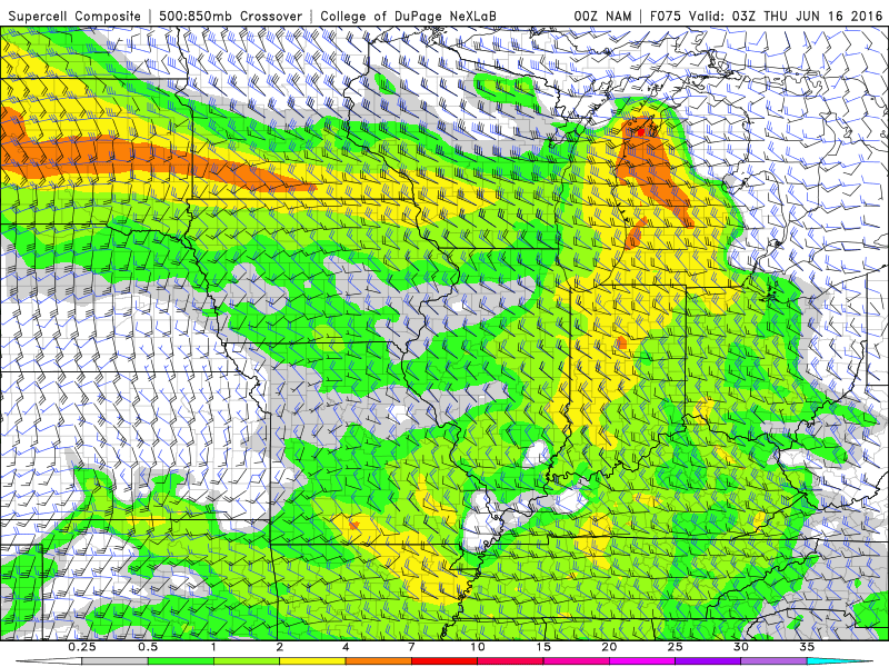
The "mixed layer" is the area in the atmosphere where all the action takes place. This is the area is the battlefield where the war between warm and cold air is fought. The 'deeper' the mixed layer - that is, the more vertical space on the battle field - the more carnage can take place. The mixed layer is considered "elevated" when it reaches very high up, is particularly deep and very unstable - lapse rates (temperature of air as you get higher) tend to be steep. Such conditions usually result in a weak cap at the lower levels of the atmosphere which prevents thunderstorm activity until peak heating. This is when you can get the explosive growth of supercells and severe multicell clusters depending on how favorable wind shear is for said development. This Wednesday, we'll be dealing with the remnants of an EML plume which is forecast to develop over the plains beginning today. Like all things, this can either strengthen or weaken over time, and the jury is still out on just how unstable things will be, but the SPC is for now predicting at least decent amount of the plume will remain, resulting in 2000-3000j/kg of CAPE.
Wildcards are similar to what we've seen so far this year. Previous-day convection could stabilize the atmosphere and serve to erode this mixed layer to the portion where thunderstorms are no longer viable (as what happened Saturday). Remnants of thunderstorms that produce rain and cloud-cover could cool down the surface and inhibit peak heating. Timing of the system could be off, and result in storms coming through earlier or later in the day, which could move the greatest severe threat around. The system itself could weaken further than the models predict, or be stronger than the models predict when it arrives.
To summarize:
• Yet another chance of severe weather appears "likely" on Wednesday. I'm very wary of putting too much faith in the models right now
• This system looks a bit more organized than what we've seen so far
• Winds will not be strong, but the atmosphere should be particularly unstable due to the presence of an elevated mixed layer
• Main threats would be damaging wind and hail - tornado risk marginal due to lack of strong low-level and surface winds, even though veering winds would likely be present
No comments:
Post a Comment