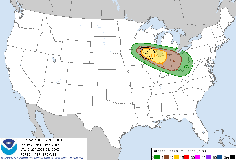
Some good news regarding the severe weather outlook for today. The models are indicating that the system will take a path more in line with what was originally expected a couple days ago, so the risk for severe weather in SE Michigan is greatly reduced. By no means are we out of the woods, make no mistake; an enhanced risk for severe weather still exists throughout the southern quarter of lower Michigan. A moderate risk also still exists for the extreme southwest portion of the state. With this in mind, I believe this event will be significant, but it doesn't look anywhere near as potentially bad as it did yesterday morning.
Widespread damaging winds are going to be the primary hazard, though a relatively high 10% chance of tornadoes exists for the moderate risk area, and a 5% chance for the enhanced risk area. A slight (15%) risk of large hail exists throughout the enhanced risk area.


No comments:
Post a Comment