Each subsequent run of the NAM has increased the conditional parameters for severe weather on Saturday over lower Michigan. The latest run is depicting quite a boost from the last in terms of potentially unstable air.
 |
| The NAM is now predicting level of surface-based instability at or above 2000 j/kg. |
 |
| Combine that with the wind profiles expected and you have surging severe weather parameters, with the supercell composite reaching 9 over central lower Michigan. |
 |
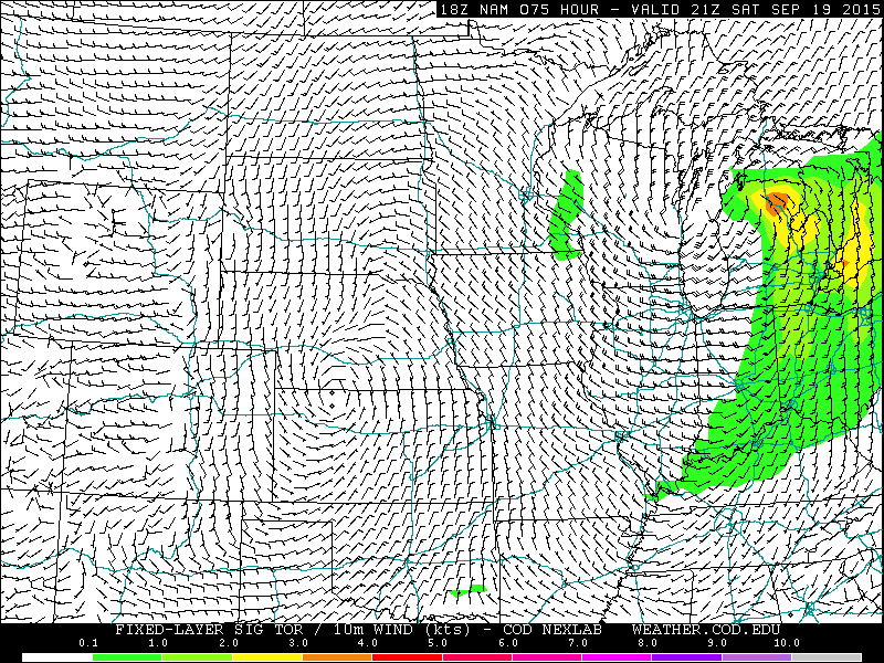
| Significant tornado potential is also predicted to go up. |
Of particular concern is the significant tornado potential rising to mid levels on the scale. This could make for a few good touchdowns should this forecast verify and should storms form/reintensify in such an environment. That's going to be the biggest factor, as this is awful close to the center of the low and I'm still hesitant to believe that leftover convection and/or stratiform precipitation that forms in this area won't negatively impact severe weather conditions.
I'm going to wait one more day to let the models chew on this one before updating the outlook for Saturday. By tomorrow, the SPC will also have something to say about Saturday. For now, there is at least a conditional marginal risk, which I will likely assign in the morning in the outlook barring significant changes in the forecast.


No comments:
Post a Comment