A very strong nearly severe line of thunderstorms looks to be moving quickly through the west part of the state into the Mid Michigan area. This line is taking on a bow shape which concerns me a bit in terms of damaging wind gusts. This is pretty crazy for this early in the morning, but the atmosphere remains very unstable throughout the state, and now there's a bit more wind to work with, but still not much.
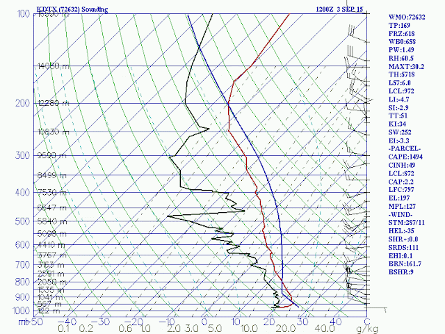
Instability will only increase throughout the morning for the eastern portion of Michigan, and it's already very high as per the 8am DTX weather balloon launch:
With that fact being what it is, there's a slim chance that this line could intensify into a severe MCS. No discussions have been put on by the SPC just yet, so it could just be a paper tiger. We'll have to wait and see.


No comments:
Post a Comment