
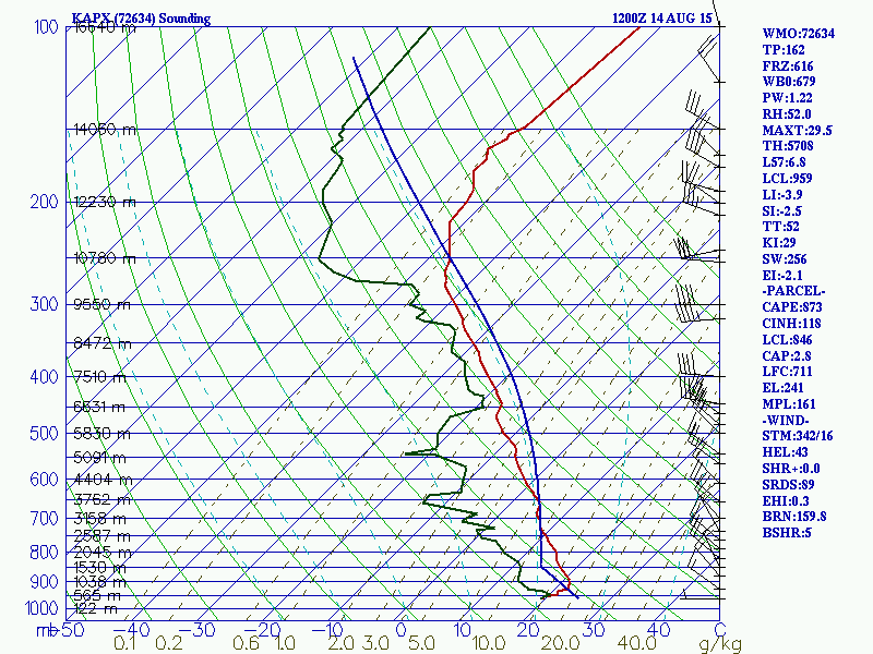

Both are showing fairly steep mixed-level lapse rates over much of Michigan, as well as very steep upper level lapse rates. A modest cap is currently keeping a lid on things. This cap will erode and most likely break over the Mid-Michigan area this afternoon, at which time numerous thunderstorms should develop. The good news for now is that the wind profile appears to be somewhat weak, but that EHI value is rapidly approaching 1, which suggests at least a marginal tornado risk.
No comments:
Post a Comment