
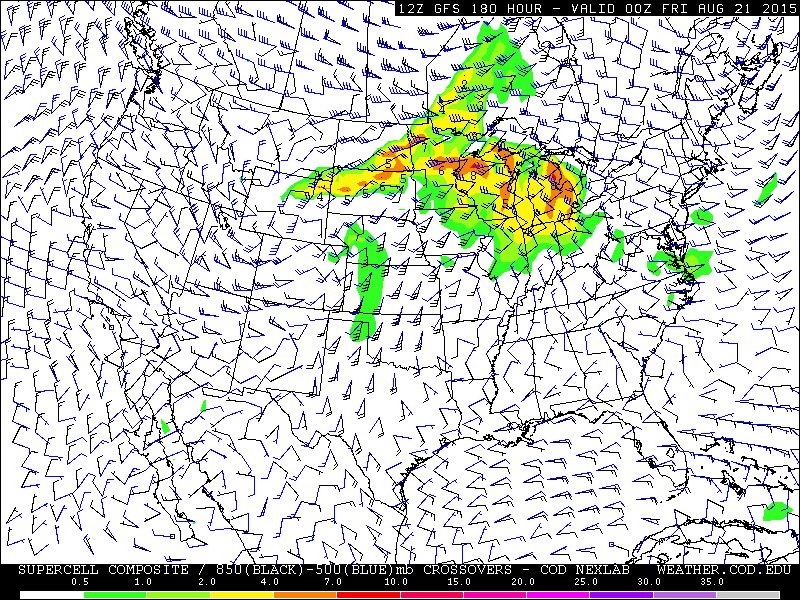
While there continues to be some run-to-run inconsistency with this particular feature, the models are depicting that a modestly powerful shortwave trough will impact a wide swath of the north central US and provide ample conditions for severe weather in several of those areas. Whether or not storms manifest will depend on a number of features, such as timing of convergence-enhancing features, but for now it appears probable that Michigan will see some storms around this timeframe, and the risk that they will be severe is significant enough for me to warrant a "Severe thunderstorms likely" outlook.
I've been keeping a close eye on this feature for a bit now and have been sitting on the fence regarding whether or not to add it to the outlook. Prior to today, I wasn't quite confident enough, and I'm still sitting slightly on the fence about weather or not anything will be able to get off the ground. However, the conditional risk should be strong enough to suggest possible severe weather, at least for now. Depending on what the models say tomorrow, I may lower the categorical outlook to "isolated".
No comments:
Post a Comment