

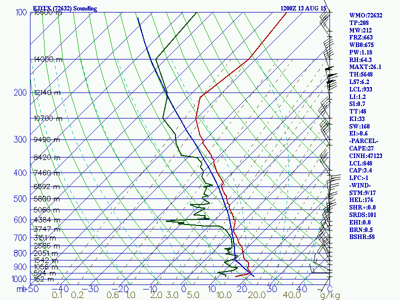
The northern sounding depicts a strong cap with very unstable conditions above it. This cap should help keep a lid on thunderstorm activity even as the afternoon progresses. However...
The southern sounding, while mostly stable, also shows the cap erode considerably. Usually, when this is the case, the central point between the soundings will be the flash-point for thunderstorms. This is what happened back in June.
The wind profiles are beginning to approach the point where I'd be concerned for severe weather. I'm not TOO concerned, but with lapse rates being what they are, if any updrafts can be sustained by wind shear, hail may become a factor very quickly. With the winds turning from the southwest to the northeast at a very sharp angle, even a tornado couldn't be ruled out. Lake breezes can also create local areas of convergence in this mess, which can amplify storm development. Instability may even be higher closer to the lake shore due to moisture advection.
It could be an interesting afternoon.
No comments:
Post a Comment